VIRTUALLY THERE

Virtually There
Maison de la Culture Janine-Sutto, Mois de la Photo de Montréal, Curated by Joan Fontcuberta, September 2 - October 10, 2015
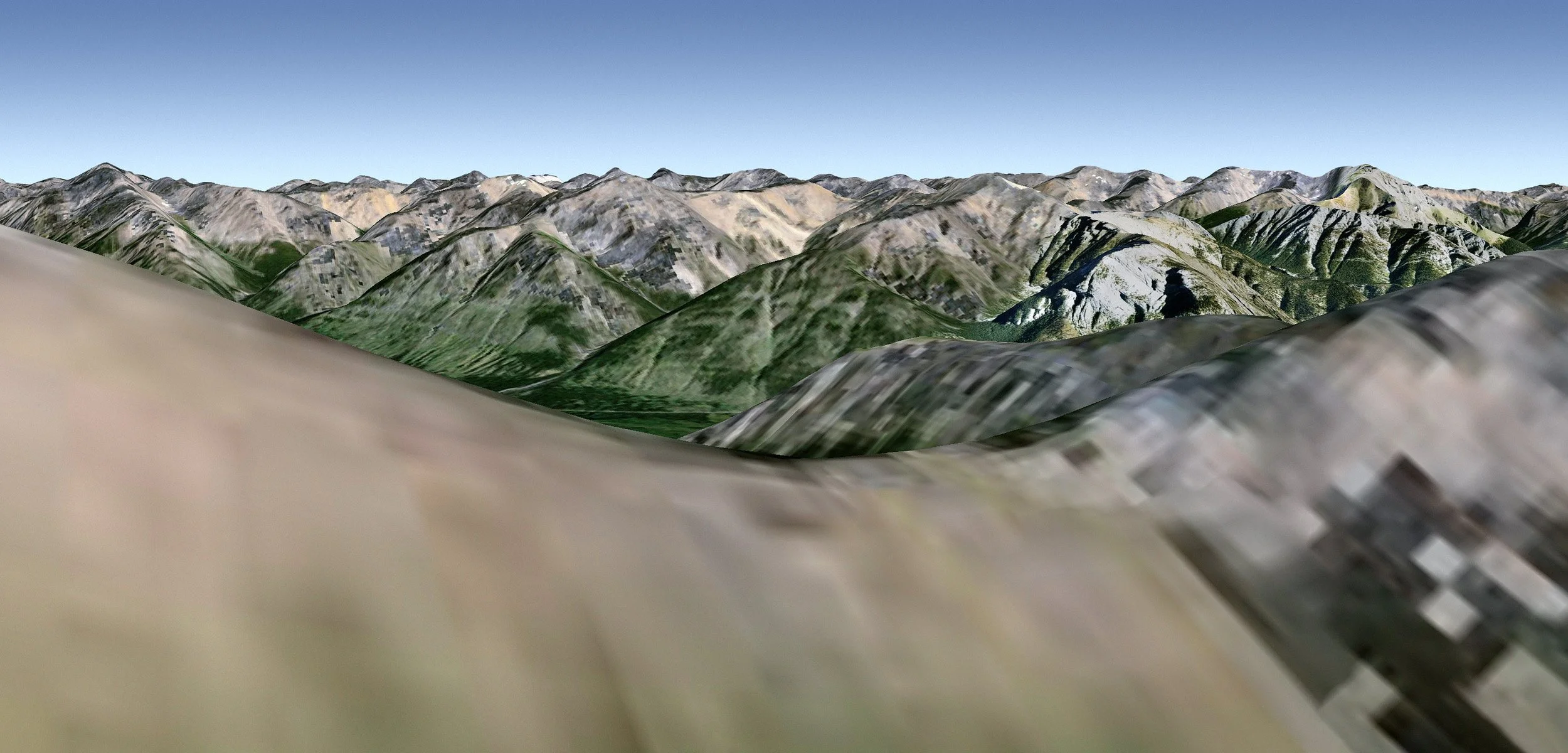
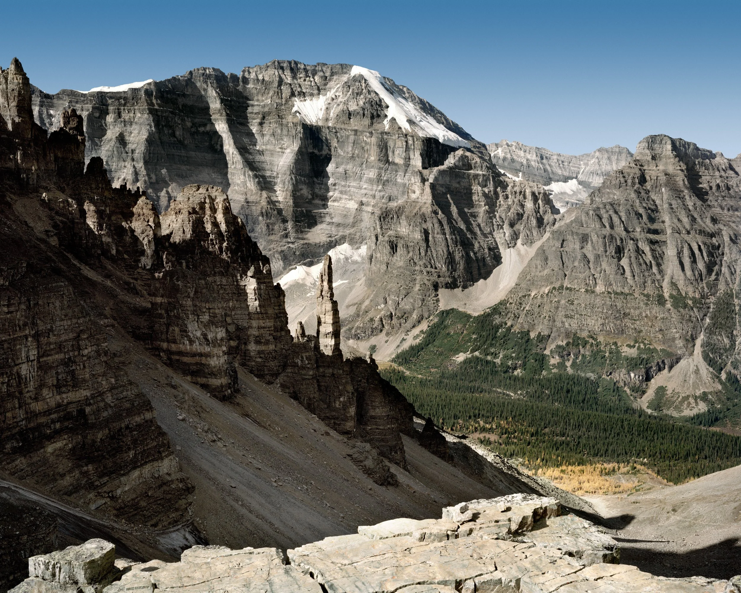
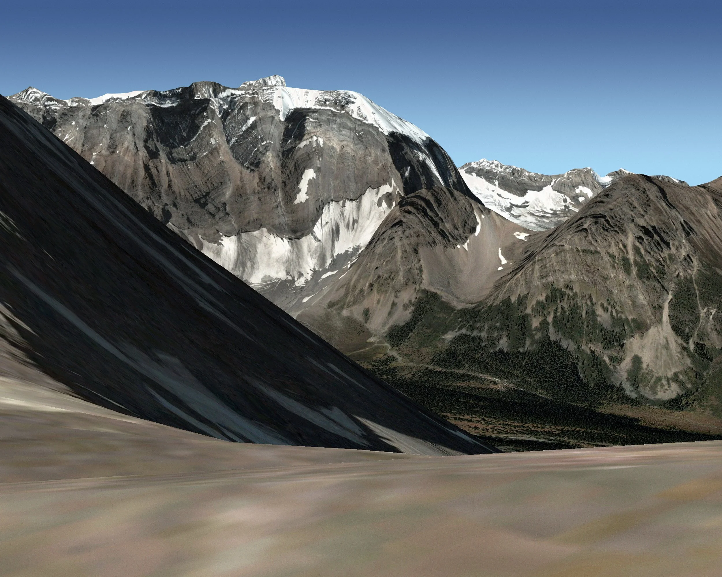
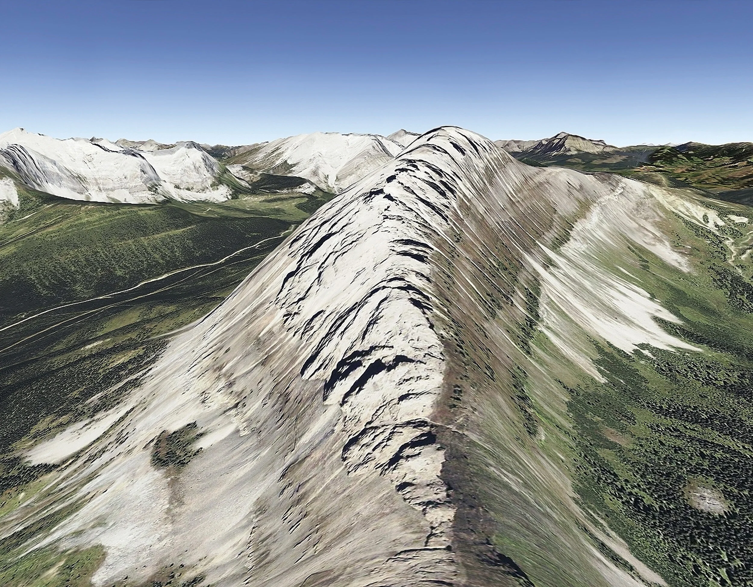
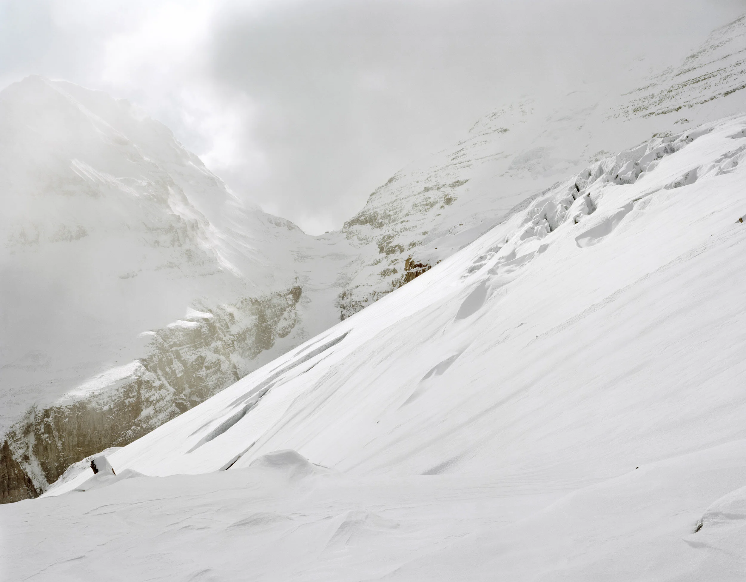
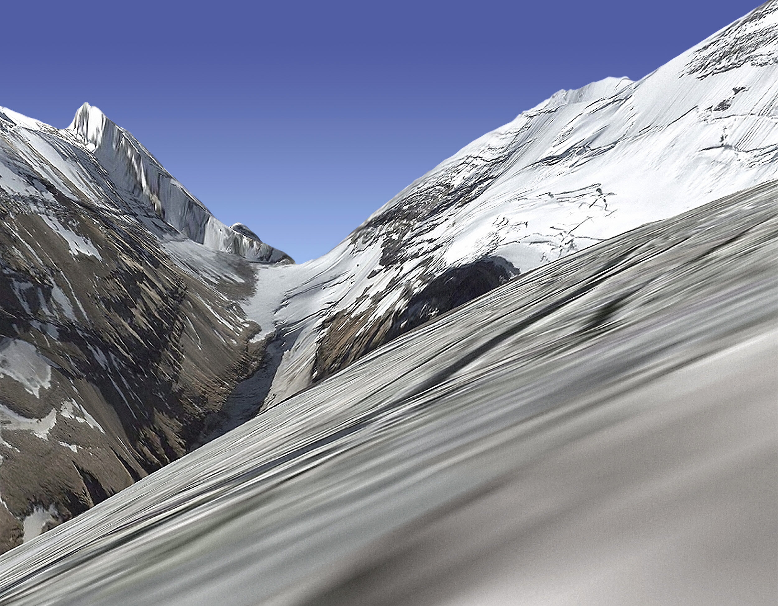
Virtually There is an exploration of the parallels between real and simulated landscapes, which began in 2009 during residencies in the Canadian Rocky Mountains. Before setting out on these residencies, I downloaded existing GPS tracks from the Internet, examined historical photographs and consulted topographic maps in order to plan routes. I then captured images in Google Earth, and reenacted the virtual journeys in real life, making my own images with a large format camera.
I continued this research until 2015, reflecting upon changes in the technology during that period, and the concept of vicarious tourism attracted renewed interest during the global outbreak of the COVID-19 pandemic.
Virtually There brings to light a discrepancy between the virtual and the actual; a discrepancy that is constantly becoming less pronounced. Both strategies of gathering pictures (in the field, versus from the web) are subjected to the same method of presentation including scale and medium. The view made in a virtual environment as well as the view recorded by the camera both offer something unique to the spectator.
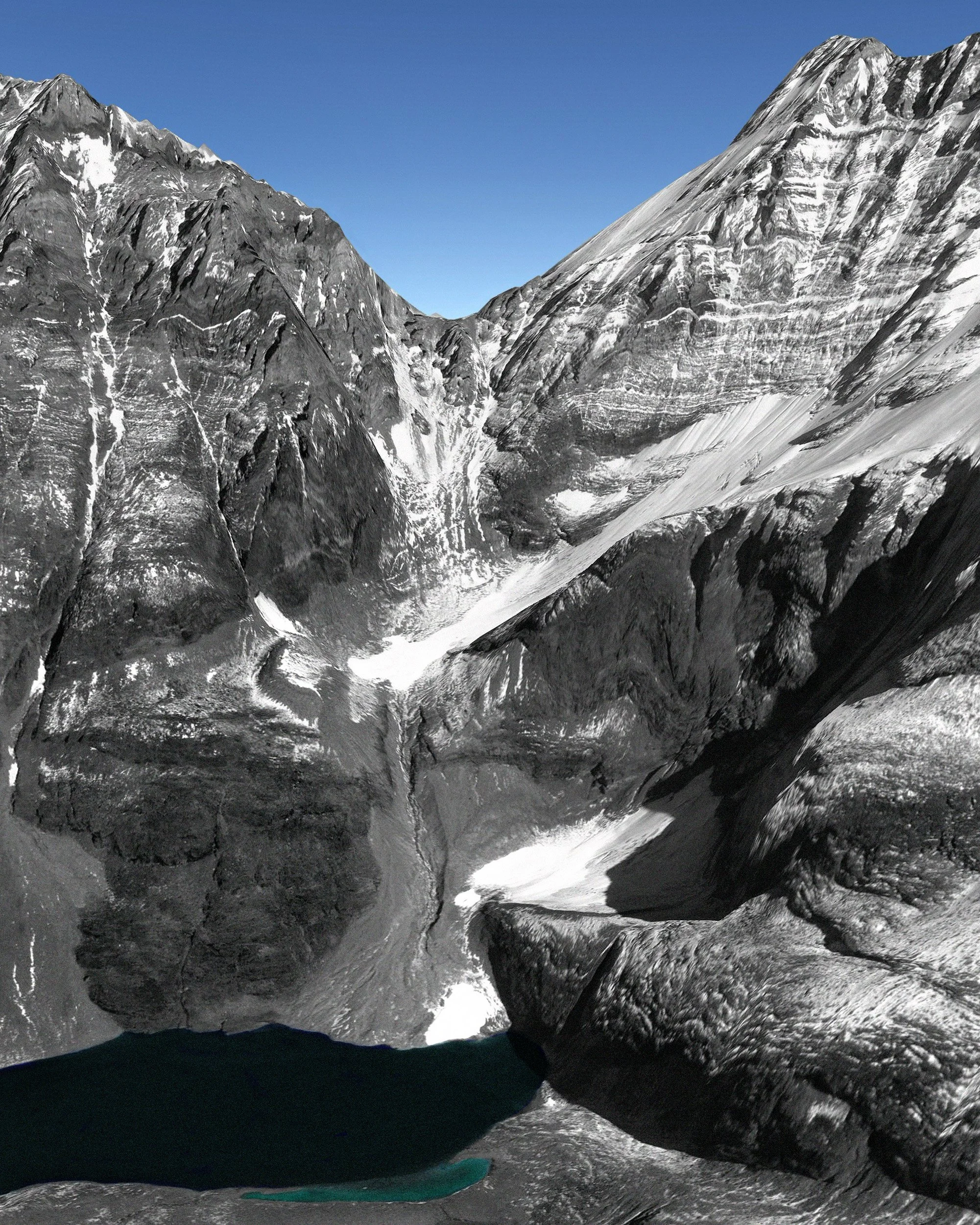


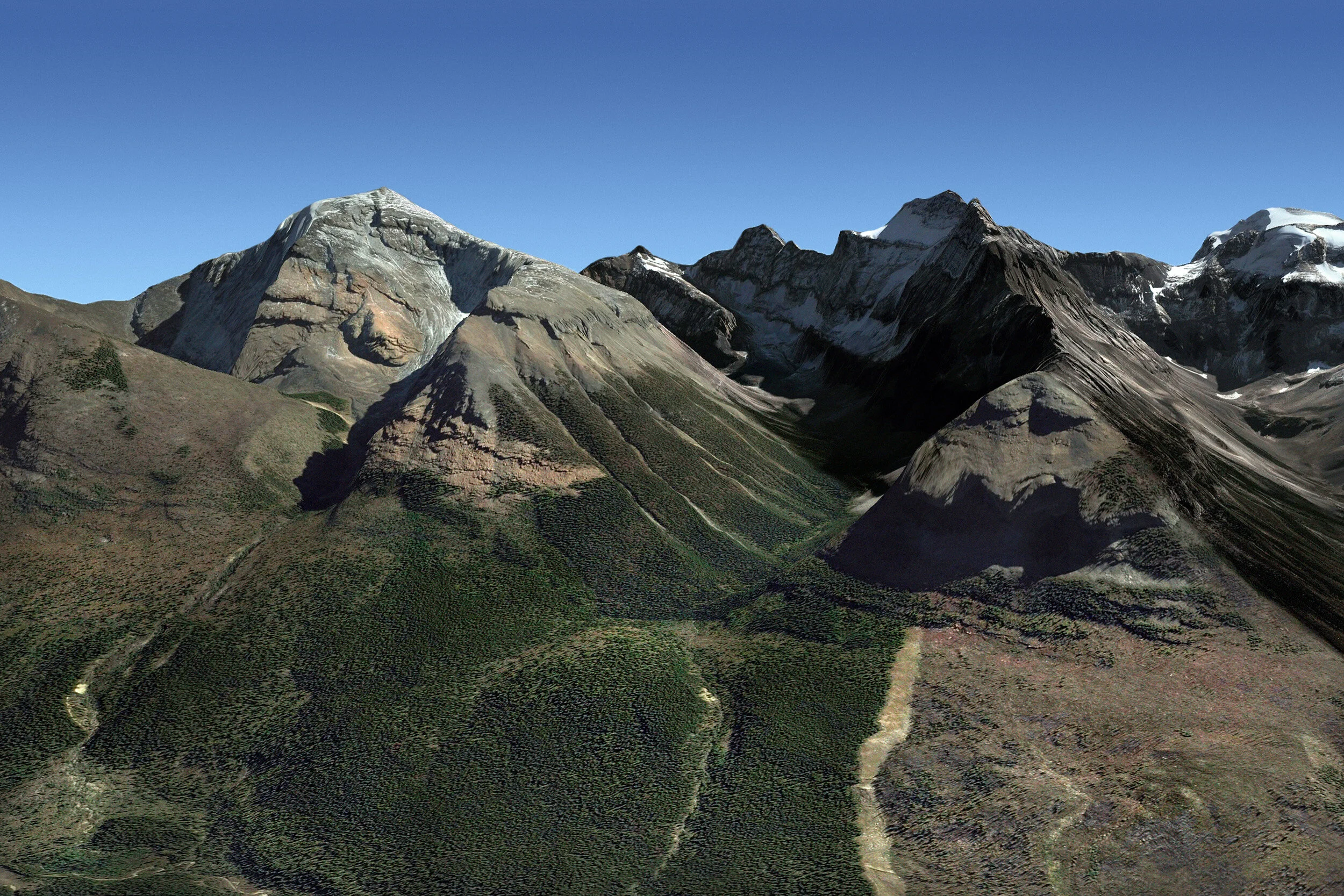
N 51º 13’ 15” W 116º 05’ 36” (Imagery Date: 4/9/2013)
self-adhesive vinyl print, 52x78”
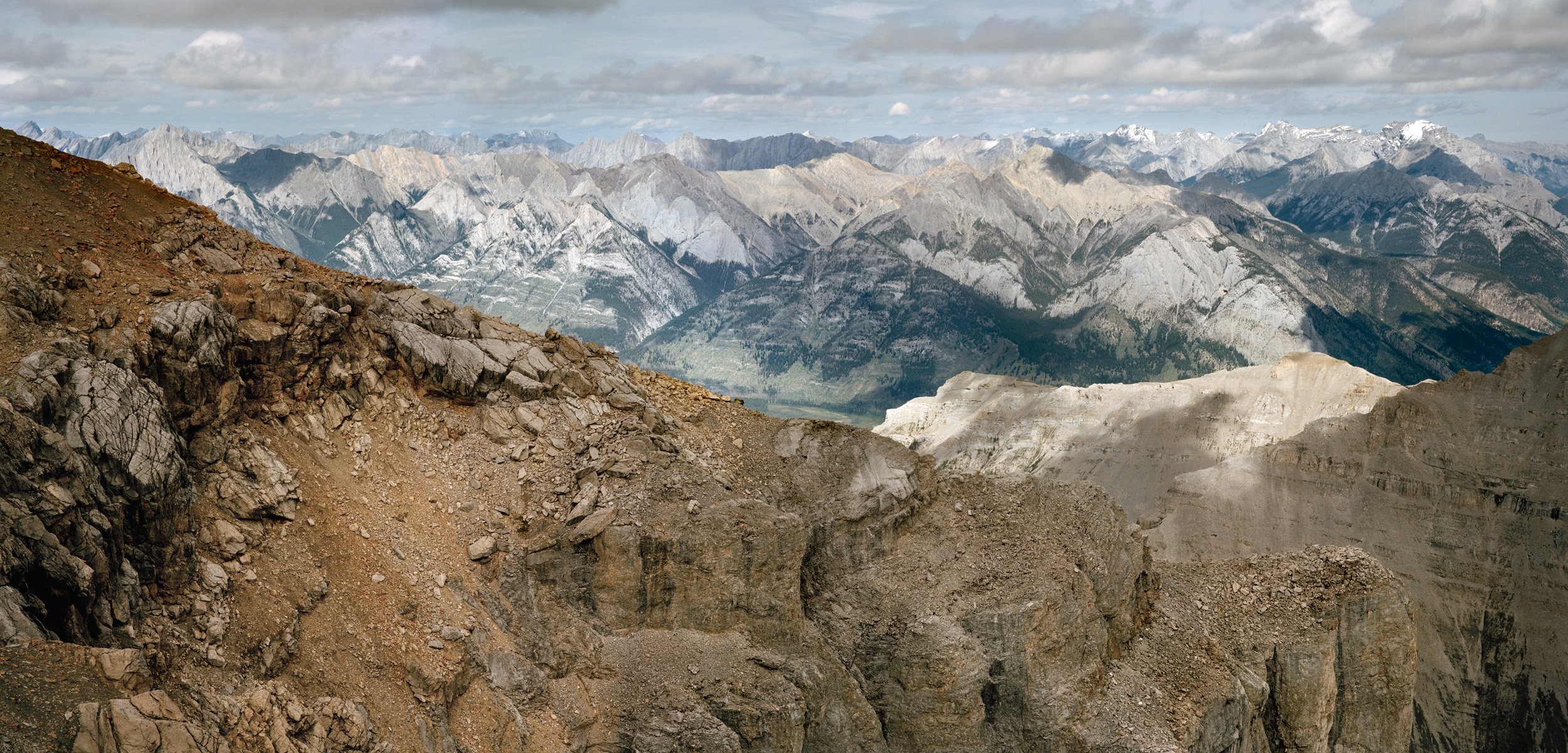

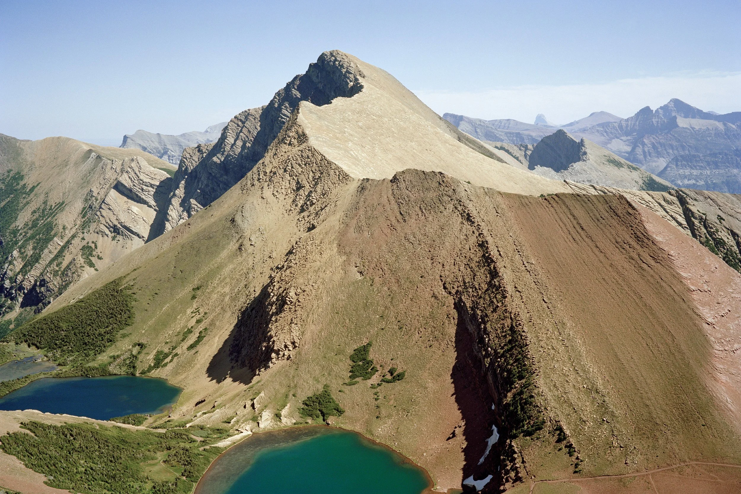
N 51° 20' 51" W 116° 20' 31"
chromogenic print mounted on dibond, 24x82”
N 45° 28' 34" W 73° 37' 18"
chromogenic print mounted on dibond, 24x82”
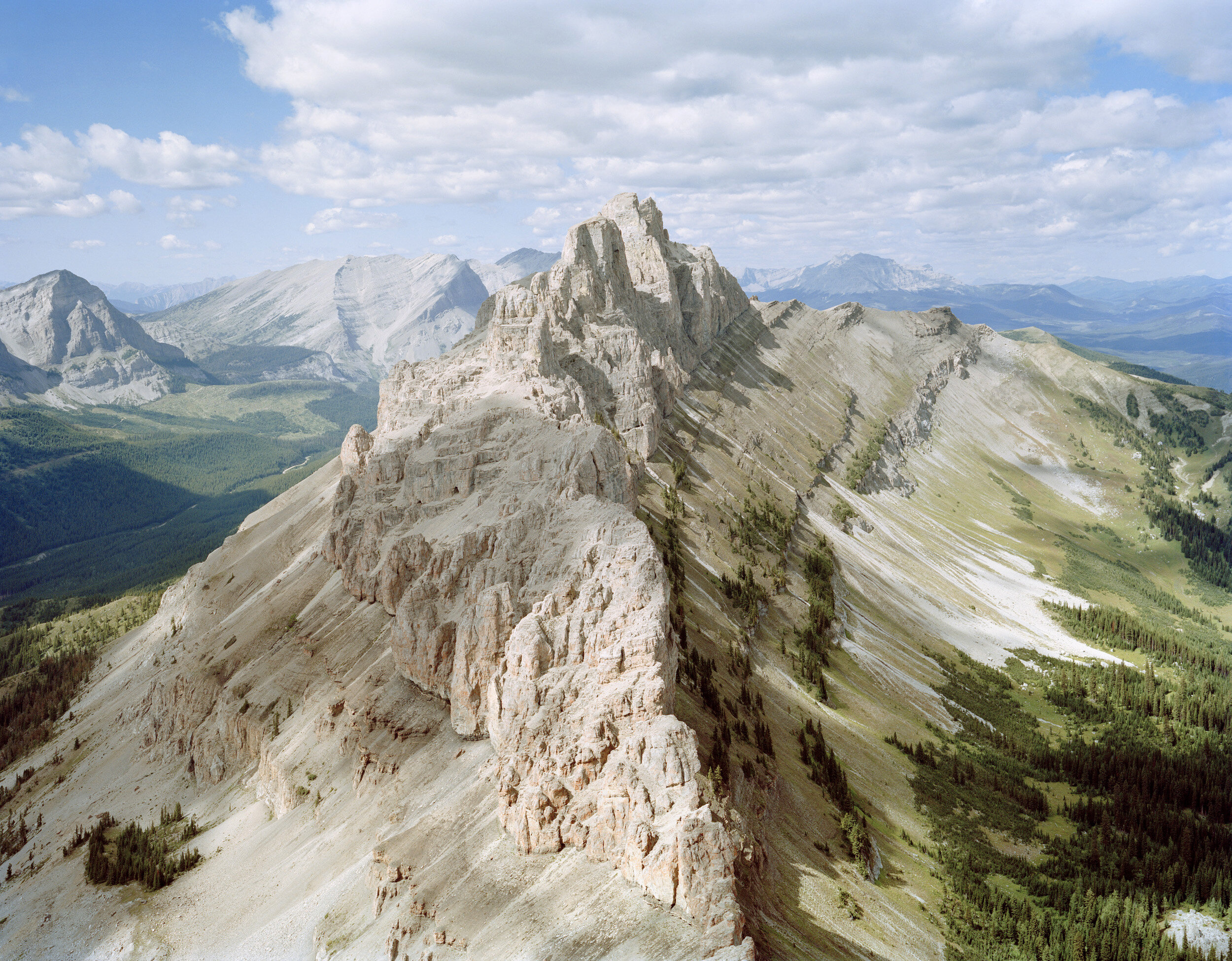
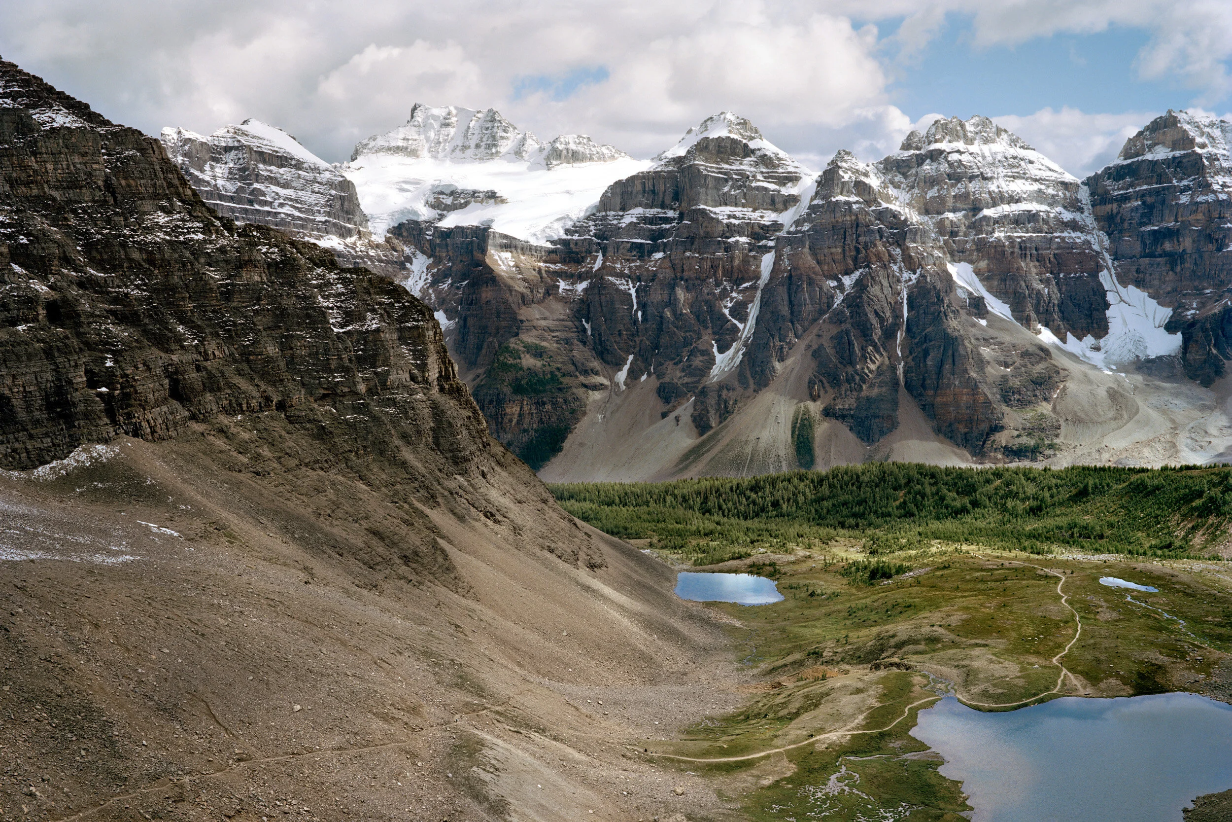
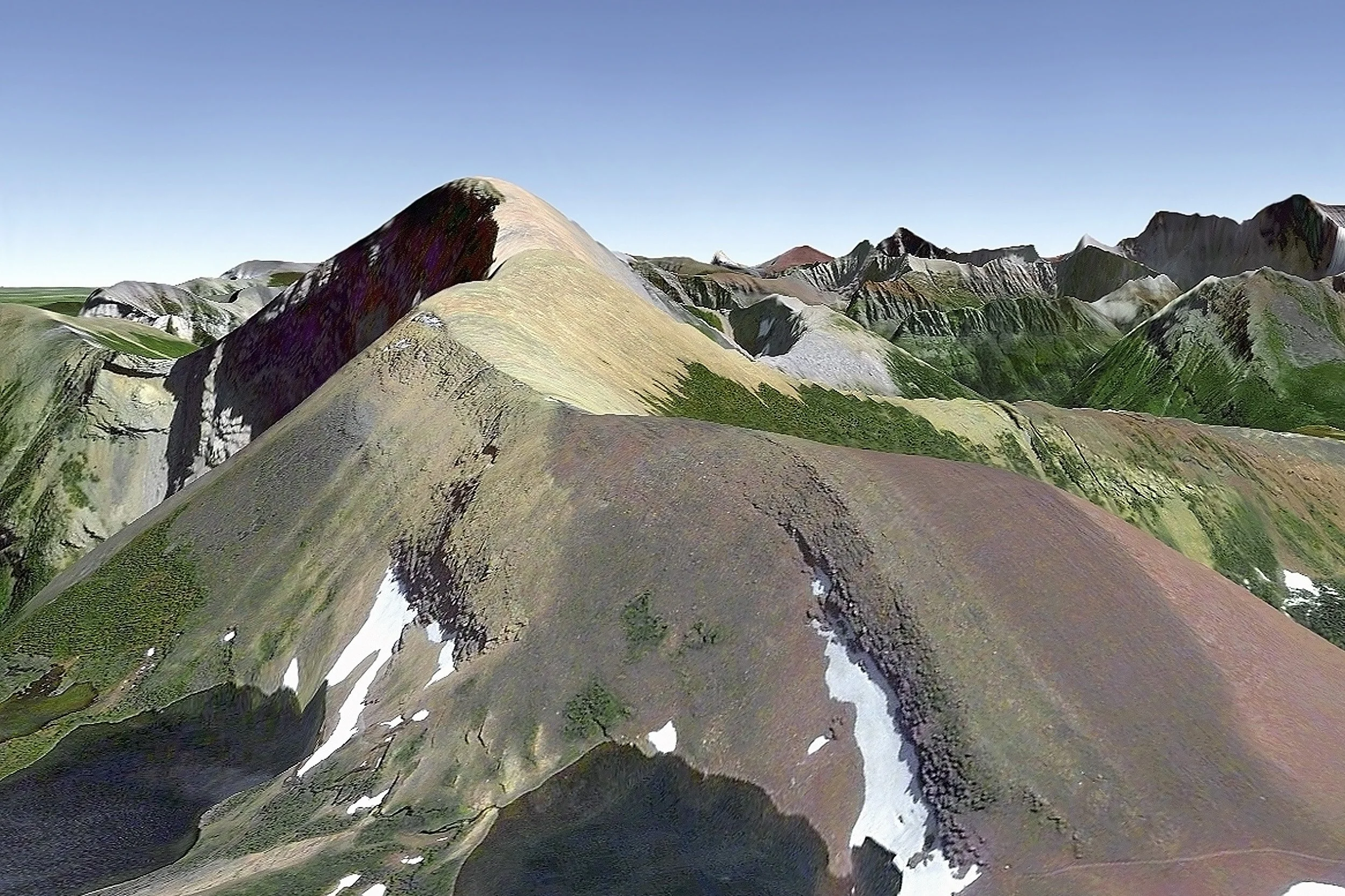
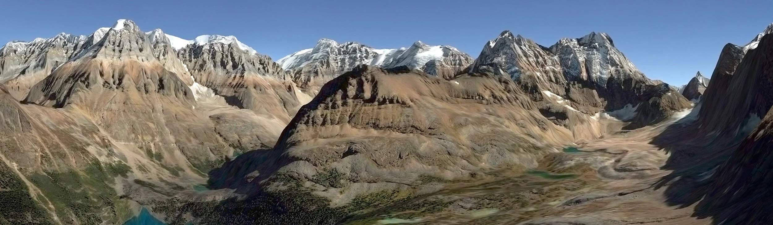
N 51º 20’ 25” W 116º 13’ 19”
self-adhesive vinyl print, 52x78”
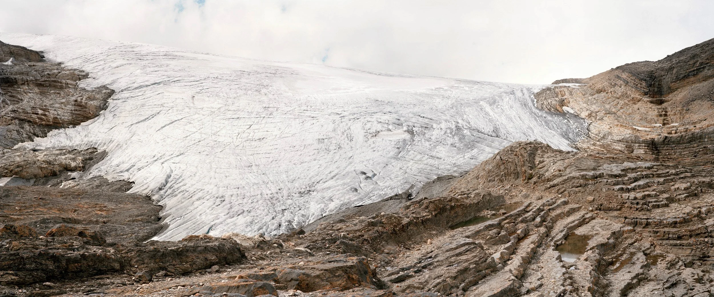
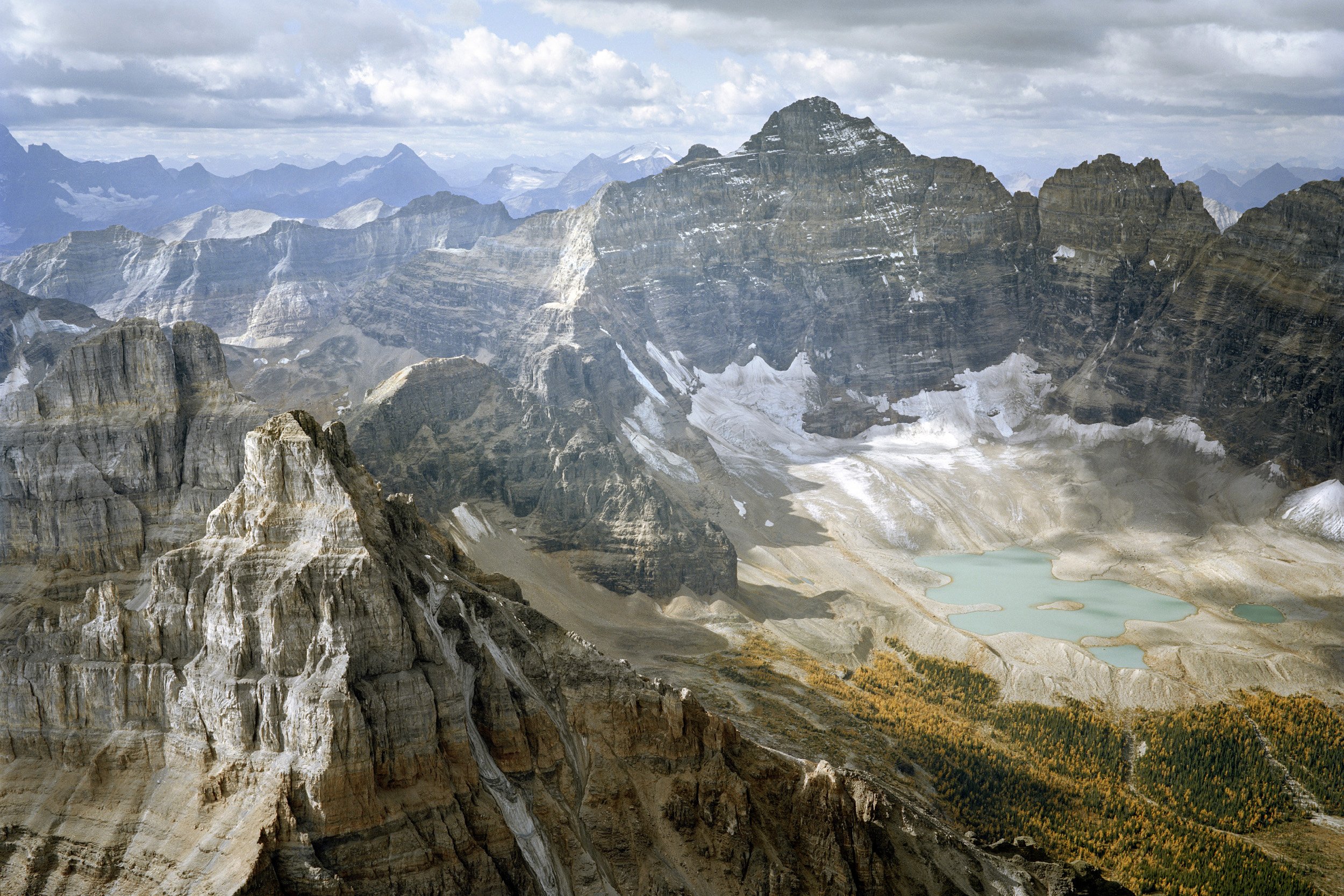
N 51º 63' 75" W 116º 50' 12"
chromogenic print mounted on dibond, 30x72”
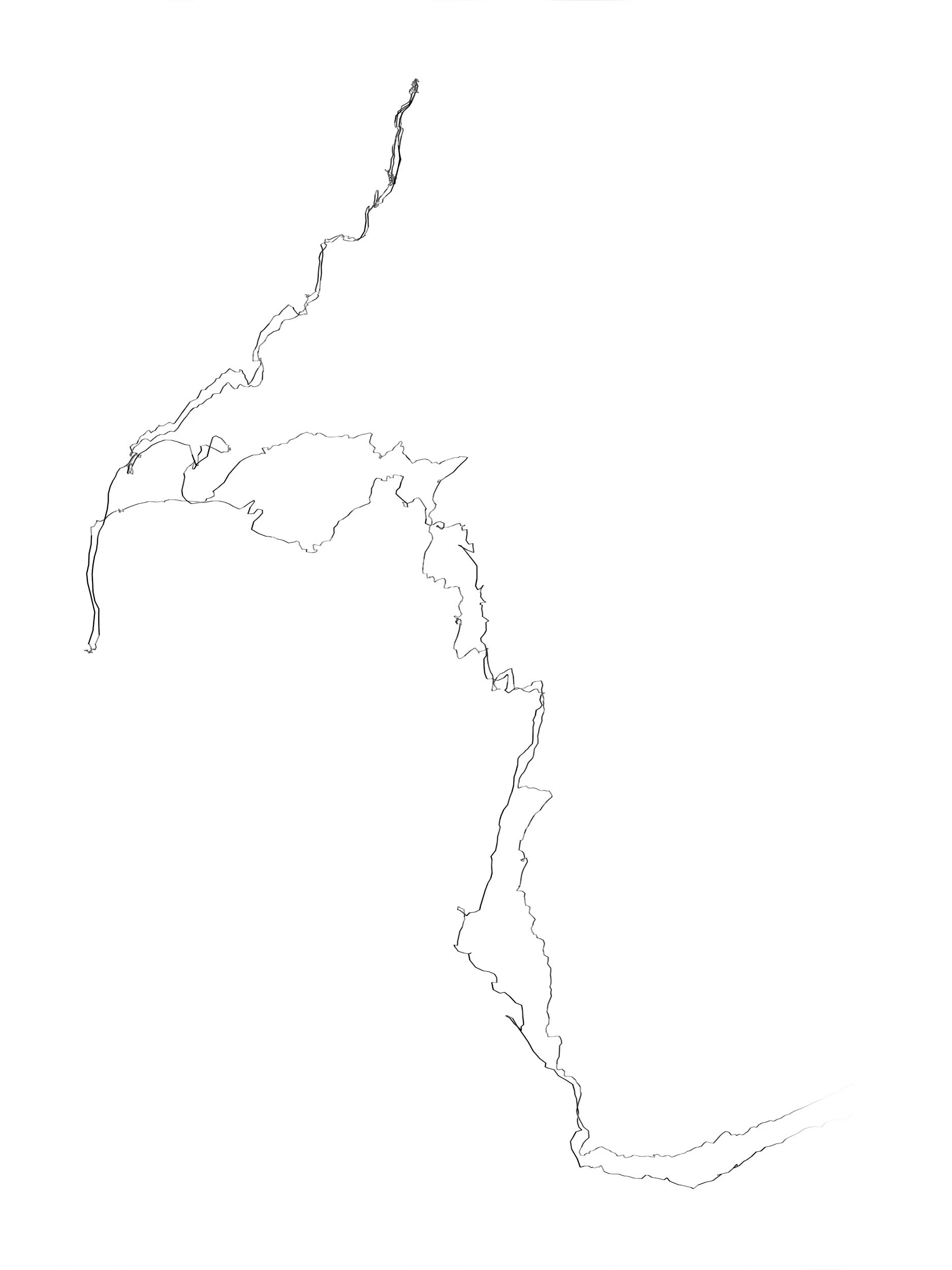
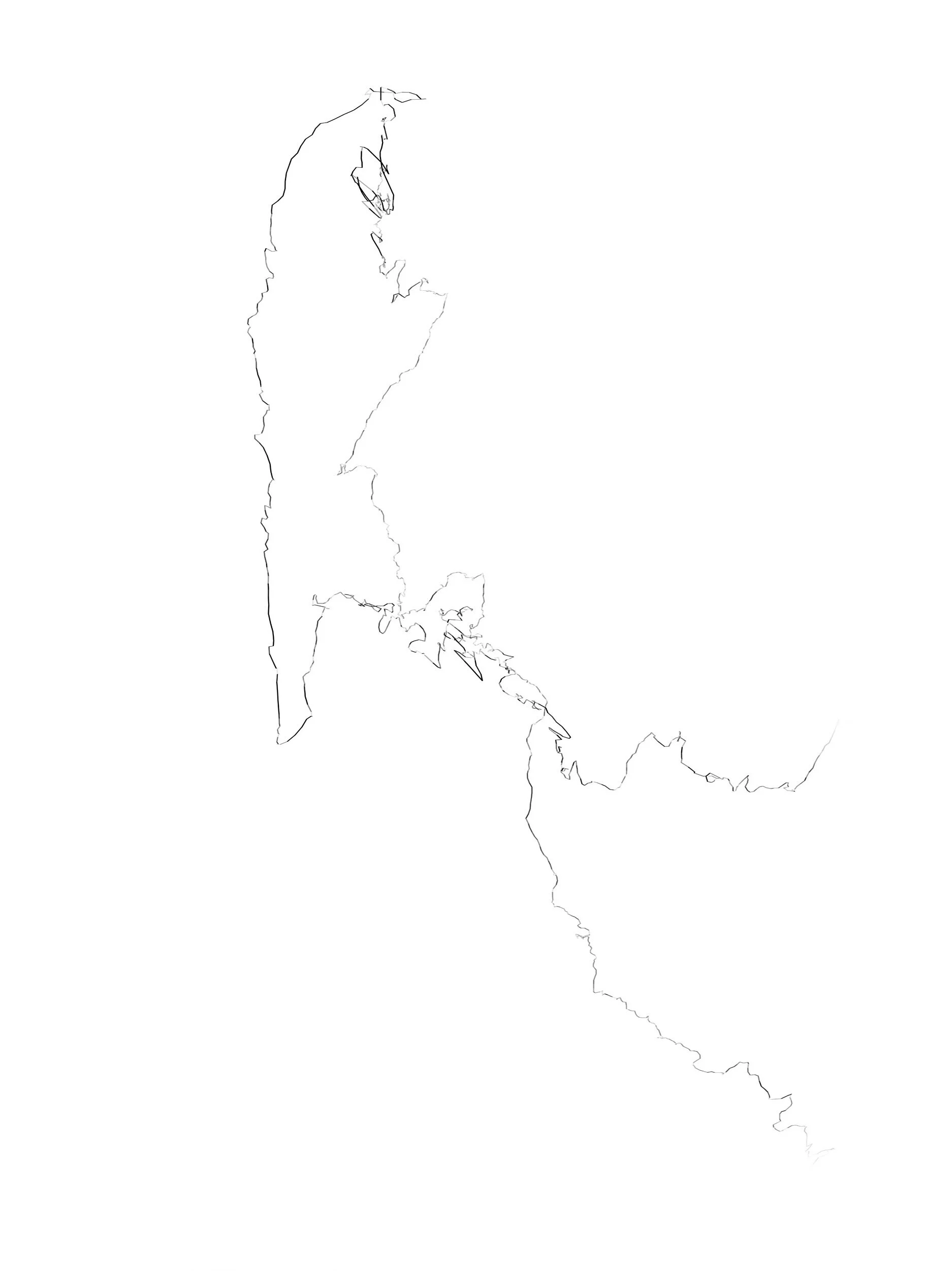
I created this series of drawings made by recording my path with a GPS. I isolated my track from any map, placed it on a white background and plotted it according to pace (the darker the line, the slower my speed). They resemble graphite drawings in quality, but are inkjet prints on Tyvek - the same material that waterproof maps are printed on, and that homes are wrapped in to inhibit moisture penetration. The titles of these works express the duration of time that is represented in each print, for example, 2 hours, 10 minutes, 35 seconds

2 hours, 10 minutes, 35 seconds
inkjet print on Tyvek, 55x44”
2 hours, 42 minutes, 31 seconds
inkjet print on Tyvek, 55x44”
3 hours, 2 minutes, 14 seconds
inkjet print on Tyvek, 55x44”
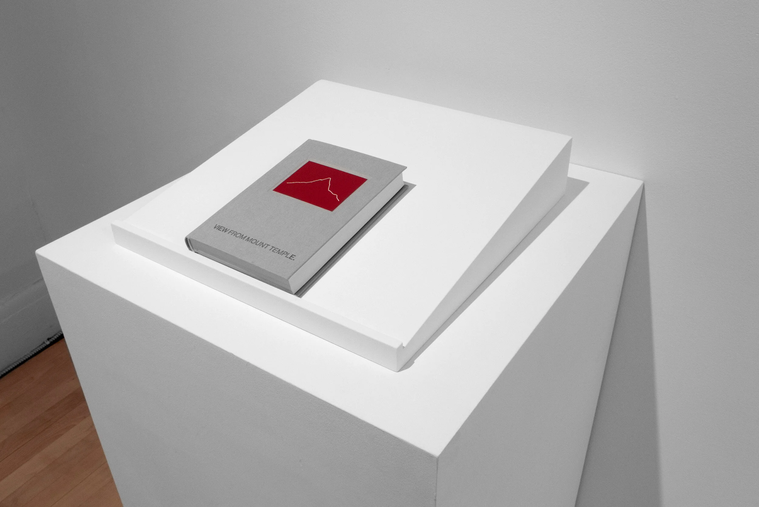
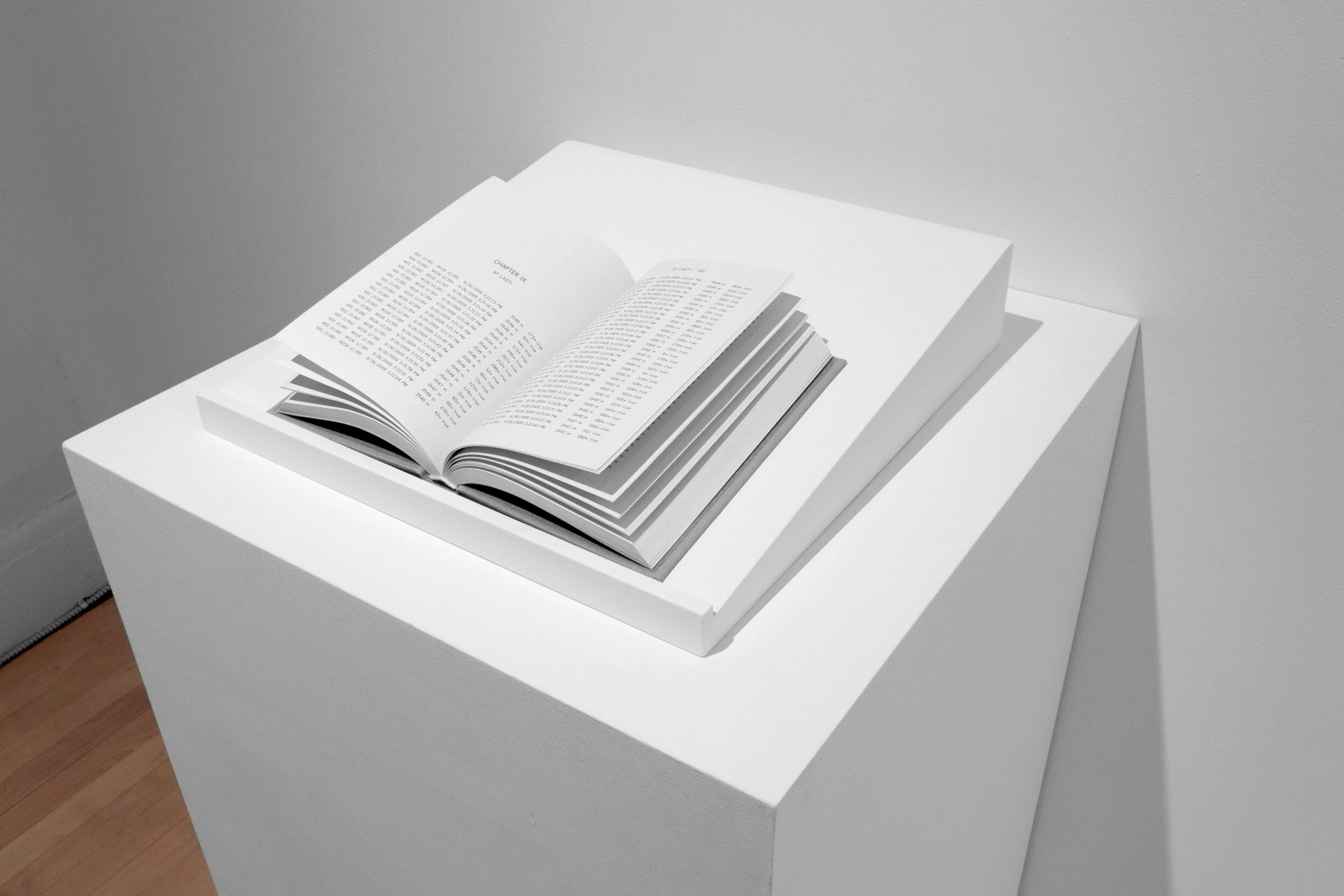
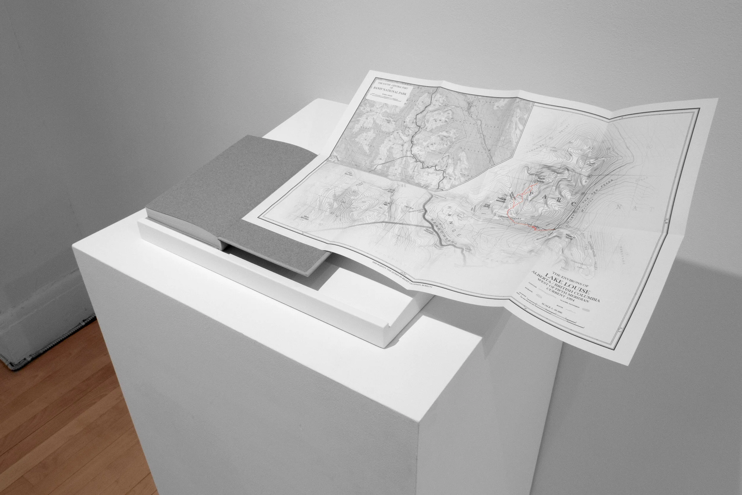
View from Mount Temple, is a hardcover artist’s book, which presents a record of my 9-hour trip climbing Mount Temple in the Rockies. This project presents plain text GPS data, which is practically unintelligible as raw information, in the form of an expedition journal. This bland, homogeneous text functions analogously to early accounts by explorers, which are also often filled with tedious factual data such as weather conditions, distances travelled, reckoning of positions and the passage of time. There is a custom made topographic map in the back which folds out revealing my trip and the surrounding landscape.
A cycle of video works made by capturing footage in Google Earth forms the final component of Virtually There. What has become a part of our daily lives, began as a unique investigation into software that was novel at the time.
The effect of transitioning from one time of day or season to another can be simulated in Google Earth by using the historical imagery slider. This tool permits the user to sift through an archive of satellite imagery that corresponds to a given location. Dissolving Views was created by taking two identical views made in different seasons, and dissolving one into the other. This process has its origins in historical lantern slide projections.
In Caché, I position a virtual ʻcameraʼ and without changing its position, I empty the softwareʼs cache. The landscape begins to materialize as the software downloads data and rebuilds the terrain.
Best General View is a time-lapse sunset to sunrise from Glacier Point in Yosemite National Park. There is a longstanding tradition in Yosemite, from 19th century landscape photography by Carleton Watkins and Eadweard Muybridge, to a renewed interest by contemporary artists. My Best General View was made without ever having looked through a viewfinder, or having visited Yosemite; it is the product of a virtual exploration.

Dissolving Views (excerpt), HD video, 14 min. 30 sec.

Caché (excerpt), HD video, 7min. 55 sec.

Best General View (4x accelerated version), HD video, 11 min. 59 sec.